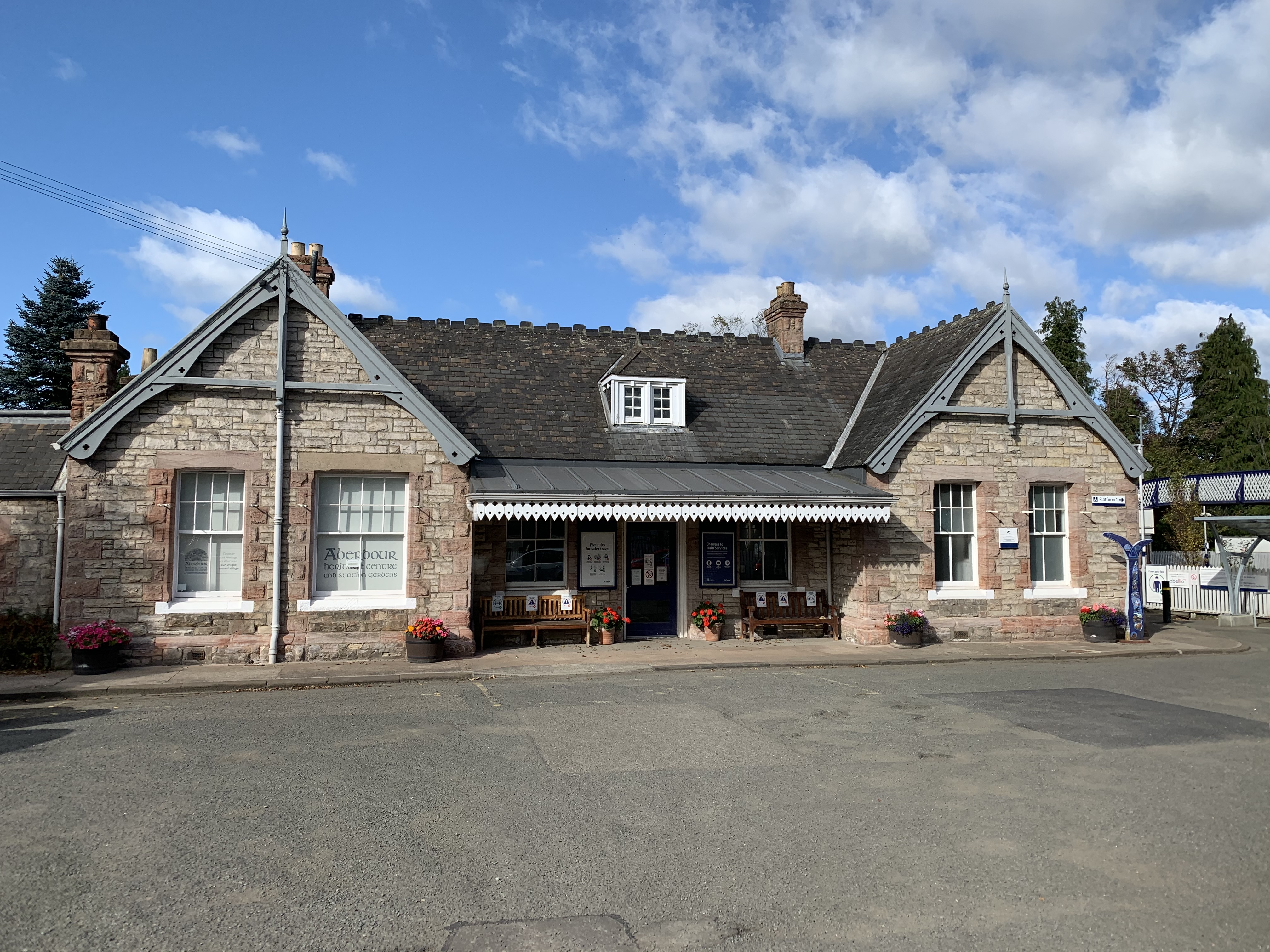


A carefully detailed late Victorian station helped transform Aberdour’s accessibility and retains a strong group of railway structures.
Quick facts
- Date
- 1890; opened June 1890
- Architect / designer
- North British Railway engineering and architectural office
- Type
- Railway station group with platform shelter, footbridge and signal-box fabric
- Designation
- Listed building, Category B (LB3629)
- OS grid reference
- NT 19073 85408
Architecture, archaeology and continuing use
The main rock-faced stone building has a broad U-plan composition and domestic-scale gables. Platform structures, glazing, a footbridge and surviving railway details create an unusually complete ensemble shaped by movement and operational sightlines.
Its story
The station opened in June 1890 as the Forth Bridge route reorganised rail travel along the coast. Easier access encouraged commuting and resort development, while continued operation has required repeated technical and passenger adaptations.
Why it is included
Category B listing recognises a coherent station group that combines architectural quality, transport history and an active role in the village.
What to notice
- Rock-faced masonry contrasted with smooth dressings.
- Platform buildings aligned for passenger movement.
- Footbridge and surviving operational elements across the tracks.
Reading the surroundings
This is an operational railway. Use designated entrances, platforms and crossings only, obey staff and signs, stand behind platform markings and never enter the track or non-public railway land.
Timeline
- June 1890 Aberdour station opened to passengers on the new coastal railway route.
- Late 19th century Improved access strengthened the village’s appeal to visitors and commuters.
- 20th century Operational changes altered equipment while the architectural group remained legible.
- 2026 ScotRail continues to manage scheduled passenger services here.
What we know — and what remains uncertain
Service patterns, staffing and facilities can change; use the live operator page rather than the designation for journey planning.
Sources & further reading
- Historic Environment Scotland: Aberdour Railway Station, LB3629 — Current designation status, mapped location, date, fabric and architectural or archaeological interest.
- Trove designation: LB3629 — Parallel national record identity and archival context.
- ScotRail: Aberdour station — Current station management, facilities and journey-planning information.
Location
OS grid reference NT 19073 85408 · Location confidence: High: the current national designation supplies an exact mapped National Grid Reference; public text separately states access and current-use uncertainty. · Select the marker to open its satellite view in Google Maps. On desktop, drag Pegman (the yellow figure) onto a blue road. On mobile, turn on the Street View layer and tap a blue road. Other photo markers may be user-contributed.
Suggest a marker correction
Suggest a more accurate position
The teal marker is the current published position. The orange marker starts slightly to its right so both remain visible; this is only a visual starting position. Tap the correct place on the map or drag the orange marker. Sending this form creates a private review entry only; it does not move the published marker.
Check this area in Google Maps Choose the Satellite layer there if useful.
Map: © OpenStreetMap contributors. You can also enter checked coordinates below.